MARIE BYRD LAND (FROZEN HAWAII)
This project is about the Earth’s southernmost continent Antarctica: Marie Byrd Land in West Antarctica. It is the largest piece of no man’s land left on Earth. It is named after the wife of an explorer, who took the first flight over the area in 1929.It is around the size of Alaska or 37 times the size of Denmark. It is not a single continent but a series of islands covered by an ice sheet, whose bedrock reminds of the geography of Hawaii. – you can think of it as a frozen Hawaii.
The area is changing fast caused by ice loss due to climate changes.In fact Pine Island Glacier by the coast of Marie Byrd Land, the largest ice stream in West Antarctica, is the fastest melting glacier in Antarctica, responsible for about 25% of Antarctica’s ice loss. As the ice sheet is grounded below sea level it is susceptible to rapid melting as a function of warmer ocean waters. As such Pine Island Glacier plays a significant role in a possible breakup of the West Antarctic Ice Sheet.
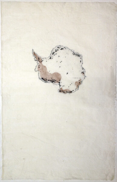
This series of prints Antarctica Ice Loss is a result of a diagrammatic mediation of observations from NASA’s Gravity Recovery and Climate Experiment (GRACE) showing how the mass of the Antarctic ice sheet has changed over the last several years thinning and rifting due to warmer oceans as s consequence of the climate changes. Satellites indicate that between 2002 and 2016, Antarctica shed approximately 90 gigatons of ice per year, causing global sea level to rise by 0.25 millimeters per year.If all ice is melting sea level will rise with up to 5 metres. Not only plays the sea ice a role in shaping a regional climate but it also has impact on the globe as it is reducing the ocean’s absorption of atmospheric carbon dioxide and blocking ocean-atmosphere heat exchange.
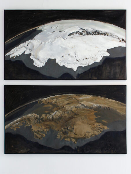
Since 2009, NASA’s mission Operation IceBridge (OIB) has flown aircraft over the Antarctic Ice Sheet carrying laser and ice-penetrating radar instruments to collect data about the surface height, bedrock topography and ice thickness. In 2013, the British Antarctic Survey (BAS) released their second topographic dataset of the bed under the Antarctic Ice Sheet called BEDMAP2, which incorporates twenty-five million measurements taken over the past two decades from the ground, air and space. In Marie Byrd Land Ice Sheet//Marie Byrd Land Bedrock these maps are transscripted into painted images of the actual and potential scenario.
Each nation of the Antarctic Treaty uses their own national flags at their respective Antarctic research bases. But as Marie Byrd Land and the Pine Island Area is an unclaimed territory no official flag exists for this area of the continent.The Marie Byrd Land Flag flag is an attempt ‑not to claim — but to make the often airy picture of Marie Byrd Land far away more identifiable, earthbound and tangible.
Back to front


